Designed for the field. Supported every step.

Our solutions are designed with the user in mind and are closely supported for ease of use — from a single site-class profile to basin-scale imaging.

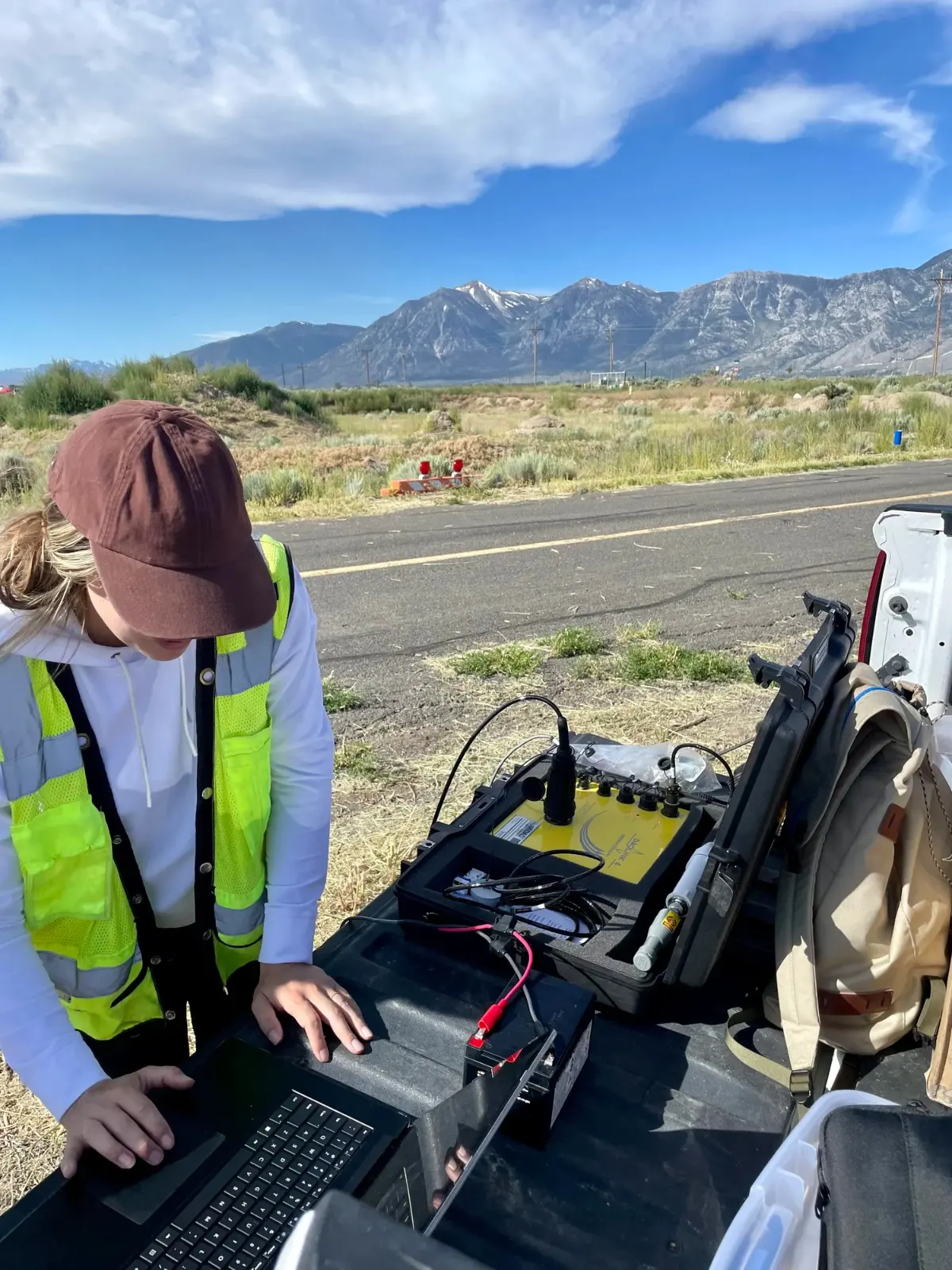
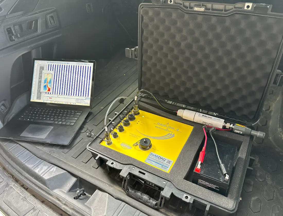
QC in the field. Check every record live and generate a report while still collecting — from the comfort of your vehicle.
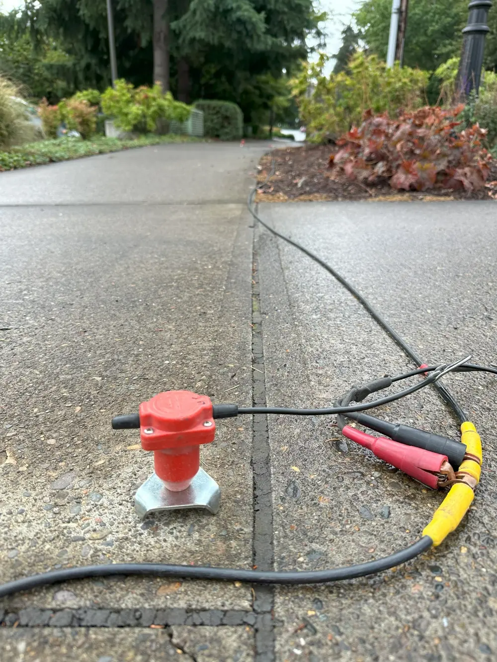
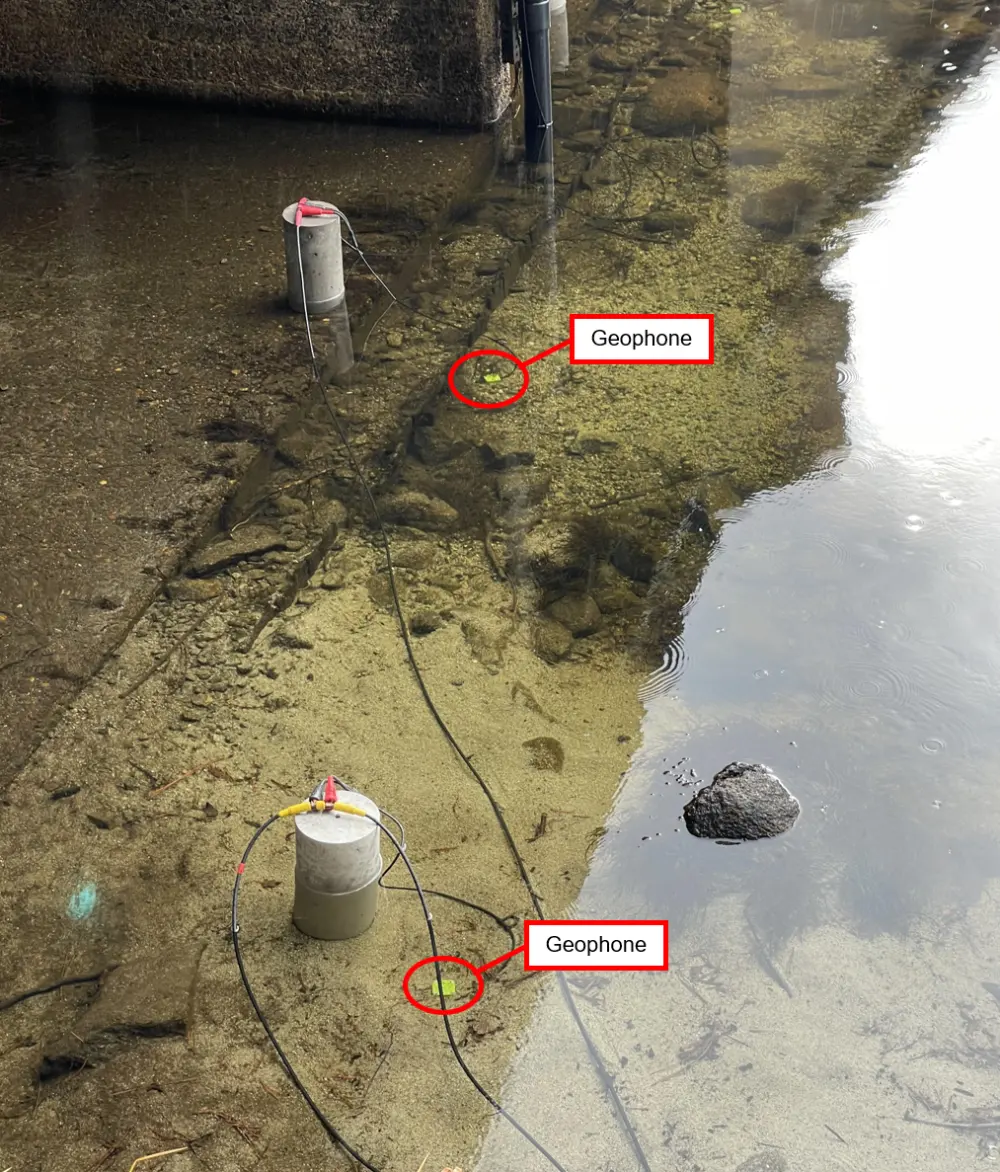
Non-intrusive. No drilling, no excavation — just geophones on the surface.
Deploy anywhere. Soil, pavement, slopes, shorelines and tight urban lots.
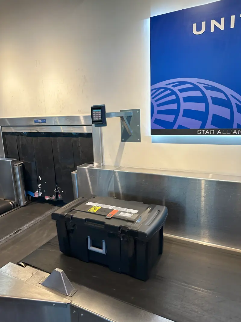
Compact. The full system packs into a single rugged case.
Easy travel. Small enough to fly with — take it to any project site.
Three ways to work with us

Software, processing, or the full system.

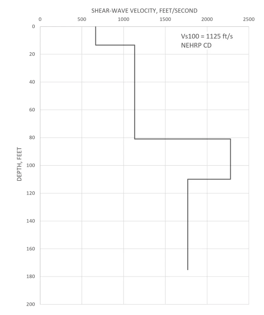
VsSurf 1dS — 1D S-wave velocity profile
VsSurf 1dS software 1D S-wave velocity profile showing site class per the IBC and depth of subsurface layers
1D S-wave velocity profile showing earthquake ground-shaking potential site class per the IBC and depth of subsurface layers.
Software

VsSurf 1dS

For making 1D shear (S-) wave depth-velocity profiles using passive and active seismic sources:

  • Determine earthquake ground-shaking potential per NEHRP and/or IBC — Vs100 (feet) / Vs30 (meters)
  • Constrain the depth and velocity of subsurface layers
  • Estimate density & rheology of earth & rock
  • Understand rippability and excavation costs
  • Reads both SEGY and SEG2 file formats
  • Auto-generate a final report
Get a Quote →
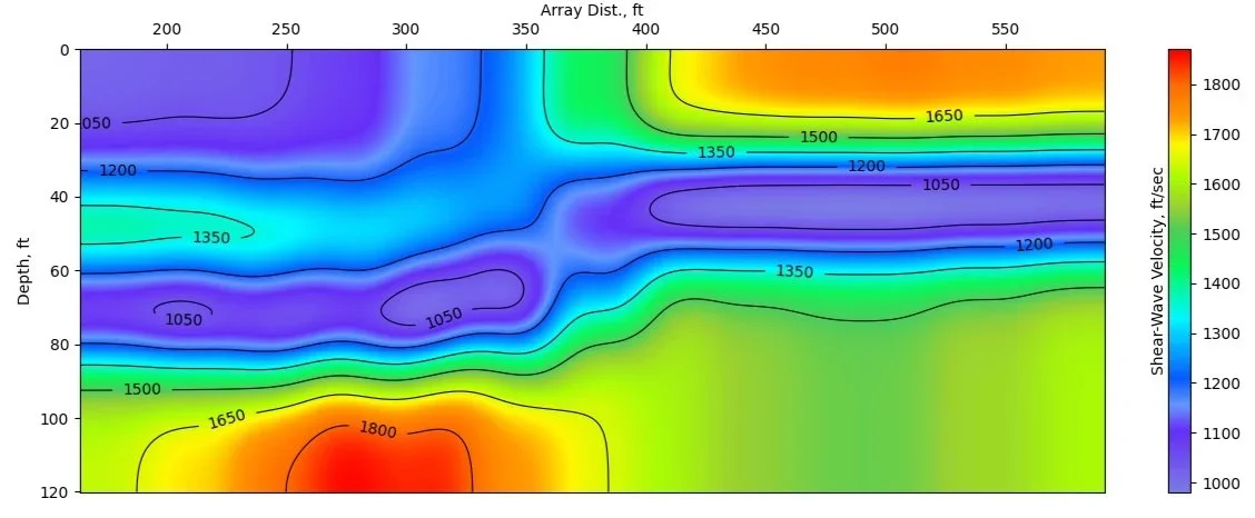
VsSurf 2dS — fault study, Las Vegas Valley
2D S-wave velocity image from a fault study in Las Vegas Valley
2D S-wave velocity image from a fault study in Las Vegas Valley, USA. A caliche layer (orange) overlies a displaced velocity reversal (purple), constraining a mapped fault at about offset 310 ft.
Service

VsSurf 2dS On-Demand Processing

Let us process your data for you — 1D & 2D S-wave depth-velocity profiles using passive and active seismic sources:

  • Evaluating rippability
  • Imaging depth & velocity to reveal the lateral extent of subsurface layers
  • Locating potential faults
  • Modeling density & rheology of earth & rock (S-waves)
  • Differentiating ore & waste rock zones
  • Monitoring earthen structures — tailings retention dams, reservoir dams, tailings piles
  • Determining the effectiveness of ground remediation, such as pilings and compaction
  • Reads both SEGY and SEG2 file formats

Our expert geophysicists deliver a final report with site class & a 2D section.

Start Processing →
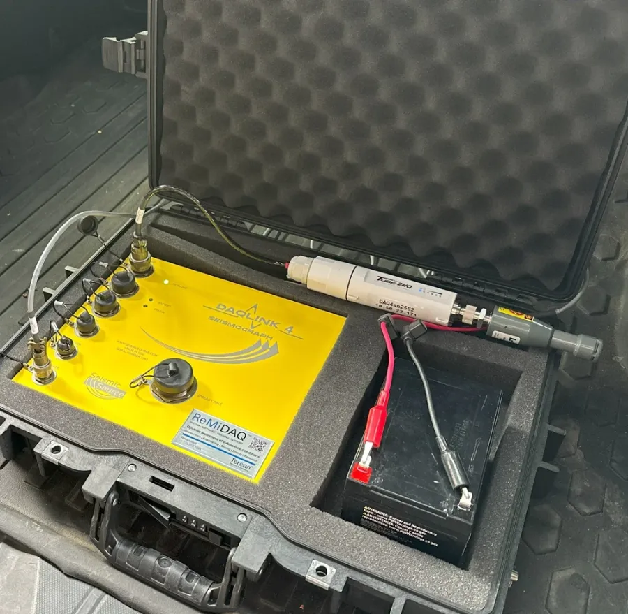
ReMi®DAQ 5 seismograph in its protective case
System

ReMi®DAQ 5 System

Everything you need to independently and confidently use seismic methods for the benefit of your projects.

  • Settings specified for use with VsSurf software
  • Wireless data transfer
  • QA/QC in the field and generate a report while still collecting seismic data — from the comfort of your air-conditioned or heated vehicle
See System Bundles →
Industries

Where ReMi® earns its keep.

01

Geotechnics

Reliably and quickly determine critical subsurface information for less; such as earthquake ground-shaking potential per the International Building Code (IBC), depth and velocity of subsurface layers, and rheologic properties of earth & rock.

Geotechnics solutions →
02

Engineering

Confidently and independently evaluate the depth, lateral extent, and rheologic properties of subsurface soil and rock layers. Constrain the location of faults and slides and determine the effectiveness of compaction and earth remediation projects.

Engineering solutions →
03

Mining

Reduce costs by covering your mineral resource ground reliably and rapidly to understand depth to bedrock, locate faults, estimate excavation and hauling costs, constrain the location of ore & waste rock zones, and monitor earthen structures such as tailings retention dams.

Mining solutions →
04

Energy

Non-invasively image basin-wide earth structure to over 10,000 feet (3,200 m) depth, to assist in developing drill targets for producing energy resources in commercial quantities.

Energy solutions →
05

Research

State-of-the-art seismic data processing software for research, teaching, and collaboration on a local or planetary exploration scale.

Research solutions →
Typical projects

What teams use Terēan® systems for.

Terēan systems are designed for engineers, drillers, and field technicians with little or no geophysical background — and our geophysicists become part of your team.

  • Seismic site classification (Vs30 / Vs100)
  • Depth-to-bedrock determination
  • Fault imaging
  • Void detection — karst & lava tubes
  • Rippability assessments
  • Landslide plane mapping
  • Liquefaction potential
  • Optimizing borehole programs
  • Tailings & reservoir dam monitoring
  • Ground remediation QA
  • Water resources
  • Mineral exploration
  • Geothermal & energy
  • Infrastructure investigations
You Collect. We Process. You Save.

Ready to see what’s underground?

Talk with a Terēan geophysicist about your site, your data, or the right system for your team.